Overview
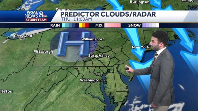
- Most areas picked up roughly 0.5 to 1 inch of rain with localized pockets near 1.5 to 2 inches before showers tapered from west to east by midday.
- Blustery northwest to north winds are ushering in much cooler, drier air, with frequent gusts in the 15–35 mph range during the afternoon and evening.
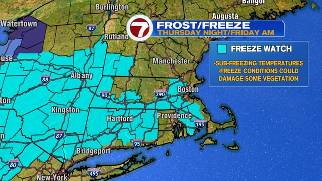
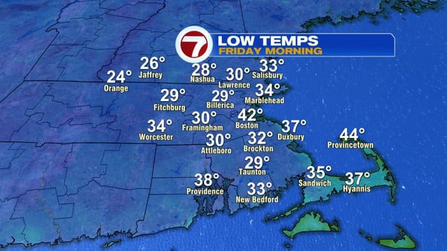
- Overnight lows are forecast to fall into the 20s and 30s in many inland spots, leading the National Weather Service to post frost advisories and freeze watches.
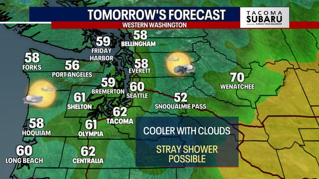
- Highs will hold in the 50s to low 60s through late week under mainly sunny skies, offering a classic fall feel after recent warmth.
- Meteorologists are monitoring a potential coastal low late Sunday into Monday, though the storm’s track and any local rain or coastal impacts remain uncertain.