Overview
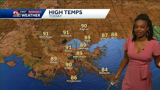
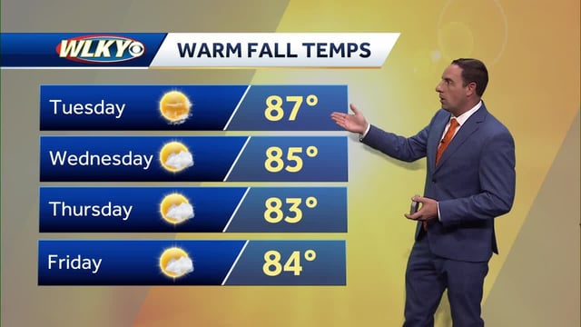
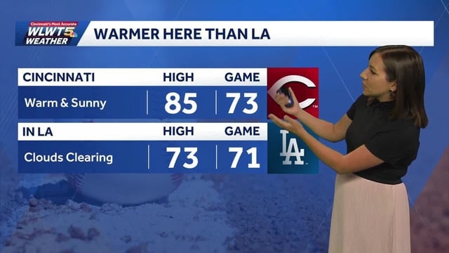
- A sprawling high-pressure ridge keeps temperatures well above normal for many areas through the weekend, with 70s to 80s common and pockets near 90 in the central and southern U.S.
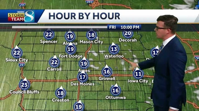
- A short-lived cool spell in the Northeast and northern New England pulls highs into the 60s and lows into the 30s–40s, prompting National Weather Service frost and freeze headlines in parts of upstate New York.
- Breezy to windy conditions accompany pattern shifts, with frequent gusts of 20–30 mph and an elevated fire danger where very dry air persists.
- Offshore tropical systems Humberto and Imelda steer away from the U.S. but bring high surf and rip current risks and deliver impacts to Bermuda.
- Meaningful, widespread rain is unlikely before early next week, though isolated showers may dot the Gulf Coast late week and this weekend with uneven totals expected.