
Overview
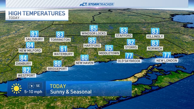
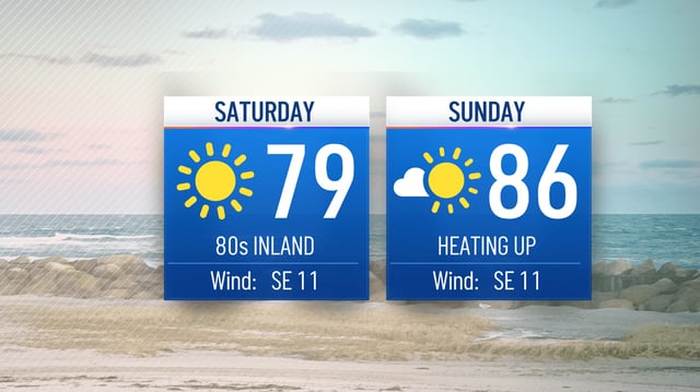
- Coastal and inland highs remain steady today and tomorrow, ranging from the 70s at the water’s edge to the low and mid-80s elsewhere.
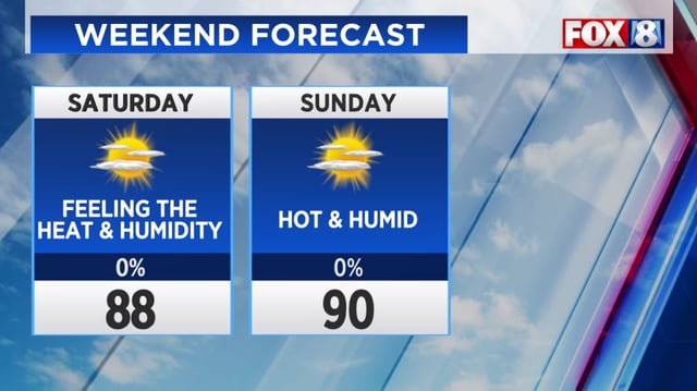
- Humidity levels will climb gradually through Sunday, marking a return of sticky air by early next week.
- Daytime temperatures are forecast to stay in the low-90s from Monday through Thursday.
- The heat index is expected to peak near 100°F on Wednesday, creating heightened risks for heat-related illness.
- Only isolated thunderstorms are expected Wednesday and Thursday as a weakening cold front passes over soils still nearly 3.5 inches below normal precipitation since June.