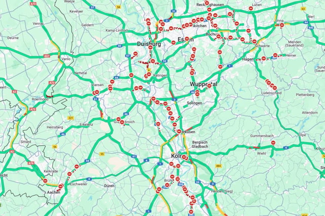

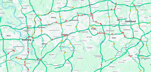
Overview
- On May 29, Google Maps erroneously flagged dozens of roads as fully closed across Germany, the Netherlands and Belgium, causing widespread confusion among motorists.
- Police in Hamburg, Frankfurt, Mainz and North Rhine-Westphalia confirmed that no such closures existed after receiving multiple user reports.
- Google removed most of the false closures by late afternoon May 29 and said it is investigating the data sources that led to the error.
- Google Maps aggregates traffic information from third-party providers, public sources and user inputs, making it vulnerable to incorrect external data.
- Drivers were advised to report errors using the app’s feedback feature and could use alternative navigation services such as Apple Maps during the disruption.