

Overview
- A stubborn upper-level ridge has trapped scorching air over the Southeast and Midwest, prompting National Weather Service heat advisories, extreme warnings and highest-level HeatRisk alerts for over 80 million people.
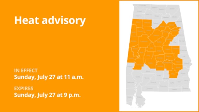
- More than 30 million residents in the Southeast remain under Level 4 Extreme HeatRisk alerts through July 31, with heat index readings forecast to spike as high as 115°F.
- Nighttime lows in the 70s and dew points hovering near 70°F are limiting relief and elevating risks of heat exhaustion, heat stroke and other heat-related illnesses.
- A sluggish cold front will trigger scattered downpours and gusty storms this weekend, but widespread humidity will persist into next week, offering little lasting cooling.
- Authorities have opened cooling centers, issued air quality alerts and warned vulnerable populations to stay hydrated and seek air-conditioned spaces until temperatures ease in early August.