
Overview
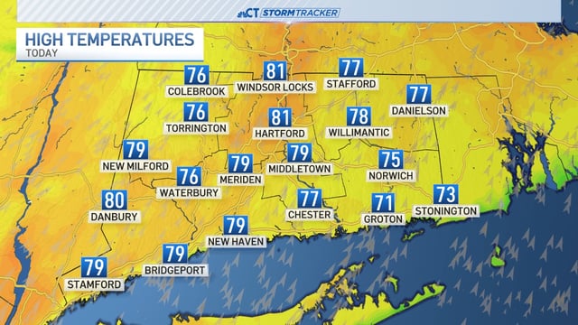
- Unseasonable warmth holds today with highs in the upper 70s to low 80s before the cold front arrives overnight.
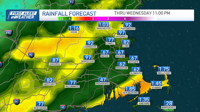
- Widespread rain moves in after midnight and tapers west to east by late morning to midday Wednesday, with a few non-severe thunderstorms possible.
- Most forecasts call for roughly 0.5–1.0 inches of rain, with localized heavier pockets; some markets flag isolated totals near 1–1.5 inches or higher.
- Road impacts include a wet Wednesday commute, brief downpours, ponding and hydroplaning risk, and slick roads after the recent dry stretch.
- Much cooler, drier air follows with highs in the 50s and 60s and inland frost or freeze possible Thursday and Friday mornings, as forecasters monitor an uncertain coastal system for late weekend.