


Overview
- Argentina’s meteorological service kept an orange alert in place for Buenos Aires (city and north of the province), Santa Fe and Entre Ríos as a ciclogénesis prolongs heavy rainfall before stronger southerly gusts arrive on Wednesday, with peak gusts forecast near 74 km/h.
- Urban impacts mounted in Argentina: Santa Fe logged roughly 56–60 mm by early Tuesday with streets anegadas, while Rosario measured about 63.5 mm—near its typical August total—prompting road closures and drainage operations.
- Accumulations across the pampas and Litoral reached or surpassed typical monthly values (often 40–100+ mm), which specialists say improves soil moisture for wheat, sunflower and early maize but worsens flooding and fieldwork delays in already saturated zones of Buenos Aires, Santa Fe and Entre Ríos.
- Mexico’s SMN and Conagua forecast strong to very strong precipitation from tropical waves 23 and 24, with daily totals ranging from 25 to 150 mm across numerous states through mid to late week, plus risks of flash floods, landslides, hail and strong gusts.
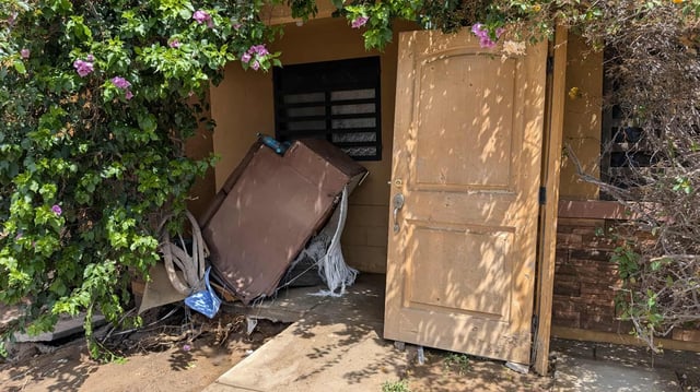
- Hermosillo, Sonora, saw concentrated northern-sector storms near 30 mm, urban flooding, multiple vehicle rescues and a CFE substation fire, as state civil protection issued an urgent advisory for dangerous thunderstorms over the Sierra Madre and the north.