
Overview
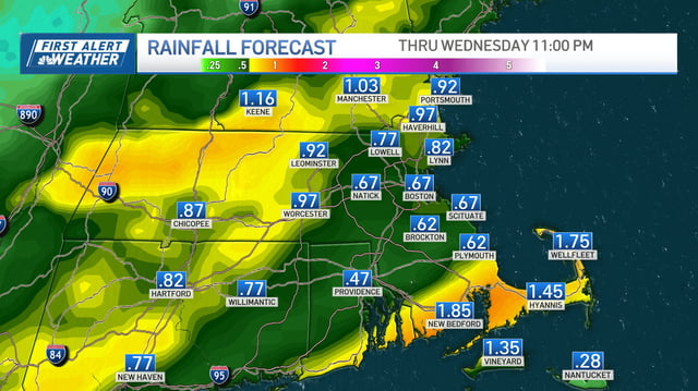
- Widespread showers move in late tonight and end by midday Wednesday, with 0.5 to 1 inch common and locally higher amounts.
- The Wednesday morning commute looks wet and occasionally gusty, with scattered non-severe thunderstorms and brief downpours.
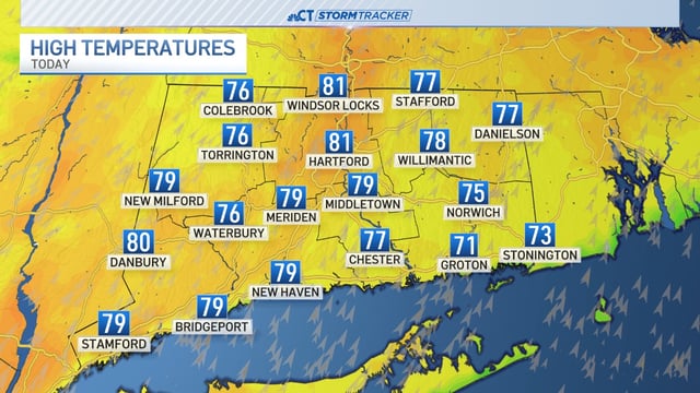
- Temperatures fall 15 to 25 degrees behind the front, bringing highs in the 50s and 60s Thursday and a frost or freeze inland by Friday morning.
- Skies clear from west to east Wednesday afternoon, followed by bright, dry weather Thursday and Friday.
- A super Harvest Moon is driving king tides through Saturday that may cause minor coastal flooding in typical low spots, and forecasters are monitoring offshore tropical development with current guidance favoring tracks away from the East Coast.