


Overview
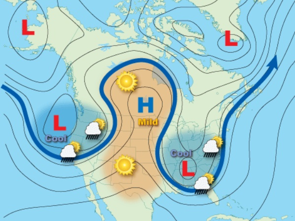
- The omega block, a stationary high-pressure ridge flanked by two low-pressure systems, is prolonging severe weather across the U.S.
- Flash flood warnings are active from the Lower Mississippi Valley into the Northeast, with saturated soils amplifying flood risks in Maine and New Hampshire.
- West Texas and eastern New Mexico face threats of large hail and isolated tornadoes, while Southeast Texas is under a level 2 severe weather outlook.
- Strong winds in the Southwest have triggered air quality alerts and red-flag warnings for elevated fire danger in Arizona and New Mexico.
- Forecasts suggest the omega block could persist through midweek, delaying relief from heavy rainfall and storm risks.