

Overview
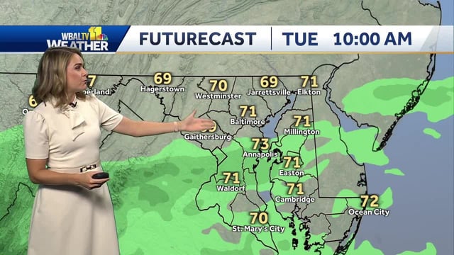
- Maryland and much of the Mid-Atlantic to New England remain mostly cloudy yet seasonably mild, with highs in the 70s and only light, spotty sprinkles mainly south of Baltimore.
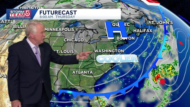
- The thin overcast is tied to Tropical Storm Imelda and Hurricane Humberto well to the south, which are not forecast to make U.S. landfall.
- Forecasters warn of increasing ocean swells, rough surf and dangerous rip currents by Wednesday, with Ocean City and other beaches advised to use caution.
- Northeast winds are expected to freshen midweek, with gusts potentially reaching 30–40 mph toward Cape Cod as the ocean becomes more agitated.
- Clearing arrives as high pressure builds, dropping highs to the upper 60s to low 70s with nighttime lows in the 40s before a warm, mostly dry weekend rebound.