


Overview
- Clouds increase Sunday ahead of a Monday cold front that reinforces onshore flow and drops temperatures below normal into midweek.
- Light, pre-frontal rain is possible in the North Bay Monday with totals generally under 0.05 inch, according to National Weather Service guidance.
- After the front, the coastal low is expected to stall for several days, keeping chances for spotty showers and isolated thunderstorms mainly over higher terrain, including the Sierra.
- Models differ on how far showers extend into lower elevations, but valley highs are forecast to slide into the low 80s by midweek before warming late week.
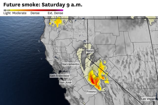
- Gusty Delta and onshore winds continue, and wildfire smoke may bring morning haze and pockets of moderate-to-unhealthy air in foothill and Tahoe areas, especially Tuolumne and Mariposa counties.