Overview
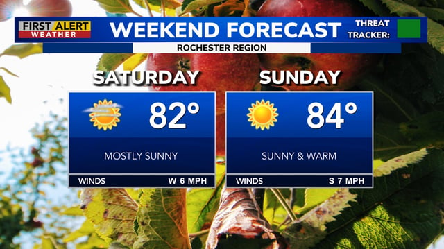
- Daytime highs are widely in the 80s with pockets near 90°F, with near-record readings noted in cities such as Chicago.
- Gusty southerly winds around 25–40 mph are accompanying the warmth in some regions, keeping conditions dry and breezy.
- The National Weather Service has warned of elevated fire danger in spots due to the hot, dry and breezy setup.
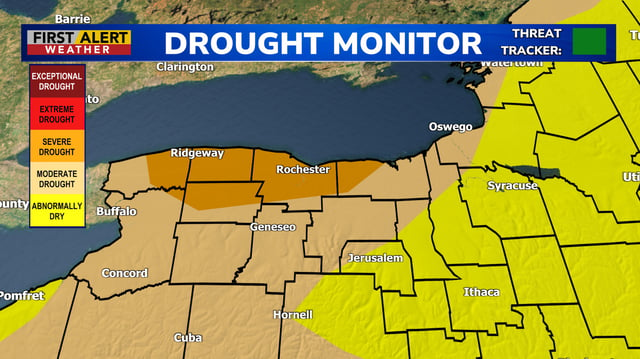
- Drought is worsening in parts of the Northeast, with portions of Western New York now listed in severe drought by the U.S. Drought Monitor.
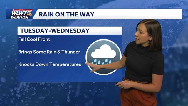
- Forecasts point to a cold front late Monday into Tuesday bringing scattered showers with roughly 0.25–0.5 inches of rain, then a shift to highs in the 60s and even 50s later in the week in some locations.