Overview
- The NA173 expedition mapped more than 386 square miles of seafloor using the DriX uncrewed surface vehicle.
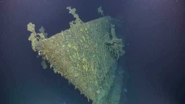
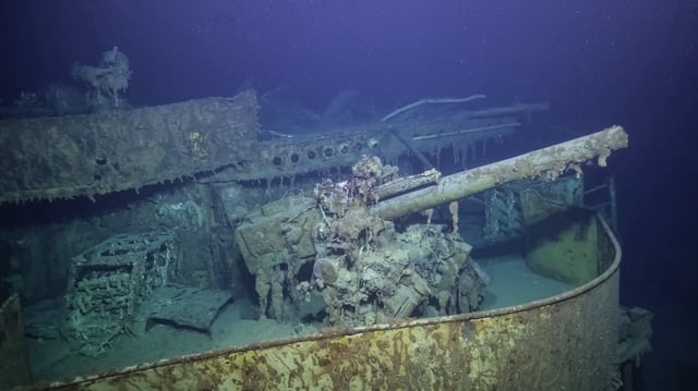
- Researchers spent 138 hours operating high-definition ROVs to capture first-ever imagery of four wrecks, including the USS New Orleans bow and Imperial Japanese destroyer Teruzuki.
- The mission streamed live footage throughout the survey, enabling more than 30 archaeologists and over 130 experts to offer real-time analysis.
- The team generated the highest-resolution visual and sonar datasets yet produced for over a dozen Allied and Japanese warships.
- Ocean Exploration Trust now has a list of dozens of additional wrecks for further investigation in upcoming expeditions.