
Overview
- Monday’s newest alert targeted Mason County, Michigan, where a 7:25 a.m. EDT storm featured pea‑sized hail, gusts up to 40 mph, heavy rain and a caution against driving through flooded roads.
- Overnight in Michigan, the NWS tracked a 1:31 a.m. EDT storm near Freeland with gusts near 30 mph across Midland, Bay and Saginaw counties, following a 10:21 p.m. EDT alert for Calhoun County with 40 mph gusts.
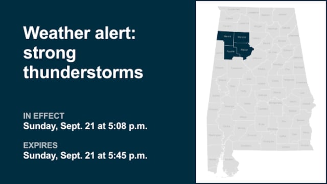
- Sunday evening in Alabama, alerts covered Perry, Bibb, Chilton, Marion, Fayette, Winston, Walker and Baldwin counties, with gusts up to 40 mph and marble‑sized hail reported in the Baldwin County forecast.
- Earlier Sunday in Oregon, Malheur County was warned of a radar‑tracked storm capable of 40 mph gusts and marble‑sized hail with potential for minor outdoor damage and blowing dust.
- The NWS emphasized that gusty winds can down limbs and toss unsecured items, frequent lightning remains a primary hazard, and anyone outdoors should move inside until 30 minutes after the last thunder.