
Overview
- An isolated supercell on Sept. 22 produced three separate tornadoes along a short corridor from west of Traverse City to Torch Lake and Bellaire, the National Weather Service confirmed.
- The first touchdown occurred near Lake Ann around 4:50 p.m. and was rated EF‑U based on video evidence, with a brief 500‑foot path and a 30‑foot width.
- A second tornado crossed Torch Lake as a tornadic waterspout and moved onshore east of the lake, earning an EF‑0 rating with peak winds near 75 mph and a path of roughly 750 feet.
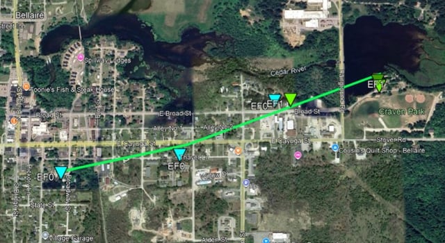
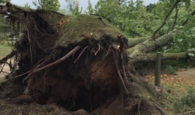
- The strongest tornado touched down in Bellaire just after 6 p.m., rated EF‑1 with estimated peak winds near 90 mph, traveling about 0.85 miles and producing spotty tree damage.
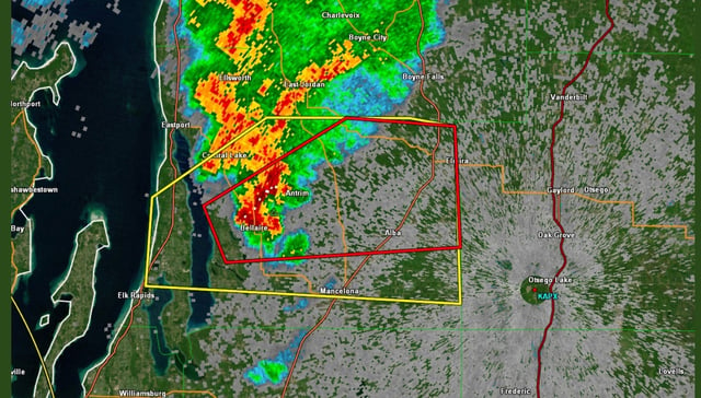
- NWS issued a tornado warning for central Antrim County at 5:57 p.m. after radar indicated rotation, and the three confirmations lift Michigan’s 2025 tornado count to 33, with 39 as the 1974 record.