Overview
- On Saturday afternoon, the NWS issued a warning for strong storms in Michigan’s Tuscola, Sanilac and Allegan counties, forecasting marble-sized hail and wind gusts up to 50 mph until 3:15 p.m. EDT.
- Later Saturday, Doppler radar triggered a short-duration alert for John Day Basin, Oregon, warning of marble-sized hail, torrential downpours and localized flash flooding through 7 p.m. PDT.
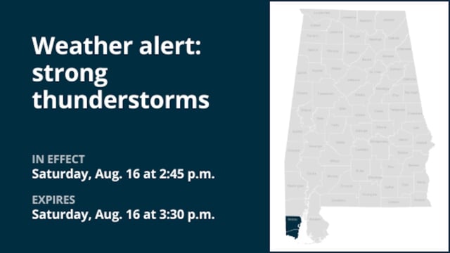
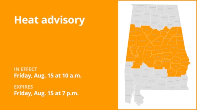
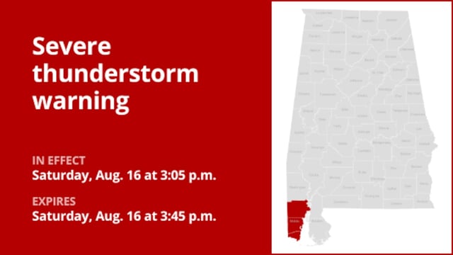
- These weekend advisories continue a mid-August trend that has already produced 60 mph winds and 0.75-inch hail in metro Phoenix and 40 mph gusts across multiple Alabama counties.
- Most bulletins are circulated in real time via automated Advance Local Weather Alerts feeds powered by United Robots alongside official NWS statements.
- Officials urge residents to seek interior shelter, avoid flooded roads and remain vigilant for lightning that can strike miles from active cells.