
Overview
- Northern states of Mexico are seeing 1–4 °C above-average temperatures with rainfall totals limited to 5–15 mm, marking a drier and hotter start to August.
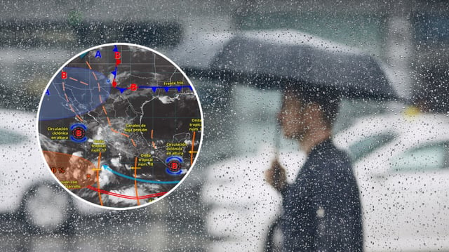
- A surge in tropical cyclone activity and monsoon channels is expected to elevate Mexico’s rainfall later in August beyond the current dry spell.
- Tropical Wave No. 19 interacting with a low-pressure trough is unleashing strong to very strong rains and thunderstorms across the Yucatán peninsula with daytime highs of 35–40 °C.
- An influx of warm, dry African air will trigger a heat wave in Spain’s Region of Murcia, with temperatures likely to climb to 38 °C on Tuesday and potentially reach 40 °C by Thursday.
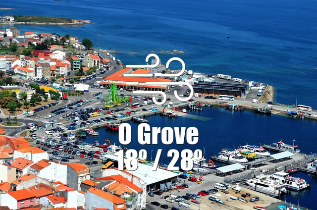
- Galicia enjoys clear, dry skies and highs around 33 °C today while Monterrey and Mexico City face light showers with highs of 36 °C and 23 °C, and Buenos Aires remains partly cloudy without rain and a maximum of 17 °C.