
Overview
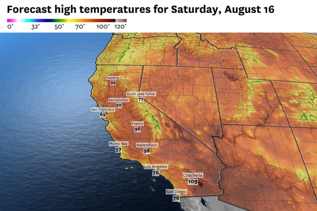
- Valley highs climbed into the mid- to upper-90s on Friday after morning clouds cleared under light Delta breezes.
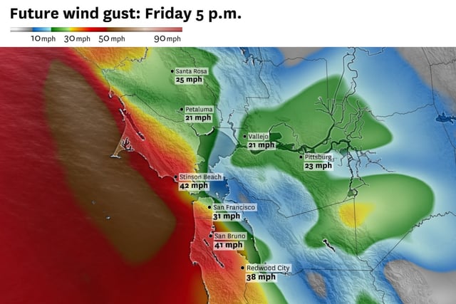
- Strong northwest winds reaching 30–35 mph prompted gale warnings and small craft advisories for Bay Area and coastal waters.
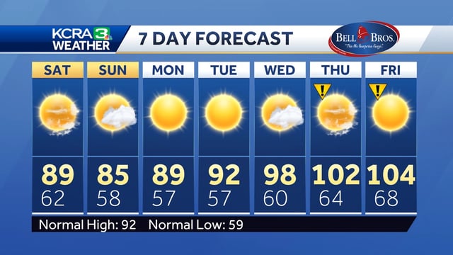
- A northwest low is set to restore onshore flow and a noticeable Delta breeze this weekend, dropping valley temperatures into the upper-80s to mid-80s.
- Leftover atmospheric energy could trigger isolated afternoon and evening thunderstorms near Shasta Lake and southeast of Tahoe, raising dry-lightning concerns.
- Forecast models indicate high pressure rebuilding by midweek, increasing the likelihood of triple-digit “Impact Days” and renewed monsoon thunderstorm potential in the Sierra.