Overview
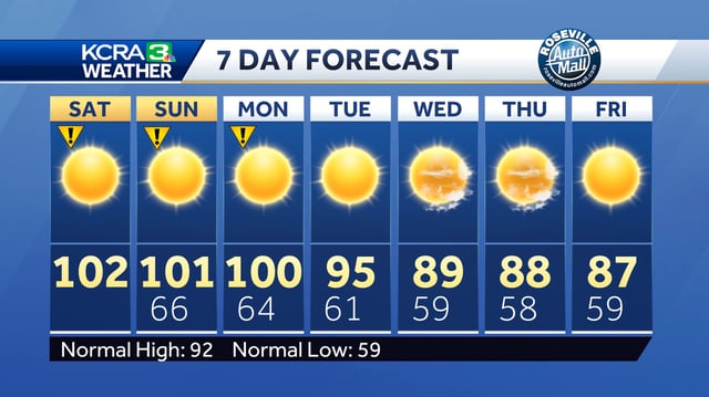
- Today begins four days of designated Impact Days as Central and Sacramento Valley highs climb into the triple digits for the first time since mid-July.
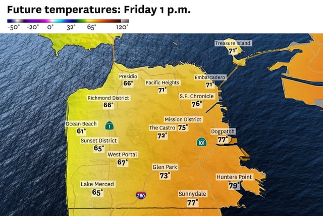
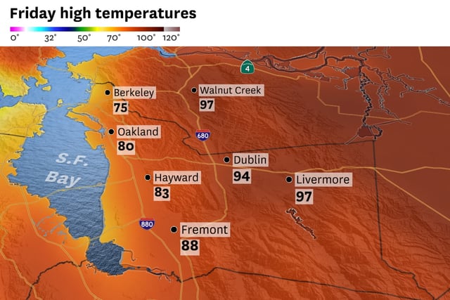
- Sea breezes will keep coastal areas milder with San Francisco highs near 70°F and inland Bay Area communities in the 60s to low 80s.
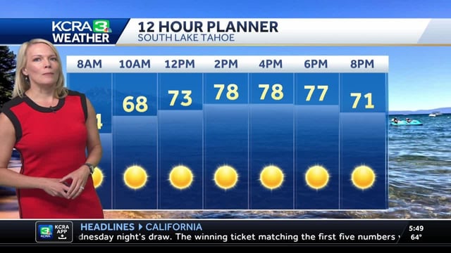
- Foothill temperatures will top out in the upper 90s and Sierra readings are forecast in the low 80s under mostly sunny skies.
- Smoke drifting from the Gifford Fire may produce noticeable high-level haze across the Bay Area without degrading air quality.
- Forecast models predict the high-pressure ridge will break down after Monday, returning valley highs to the mid-90s and dipping into the upper 80s by midweek.