Overview
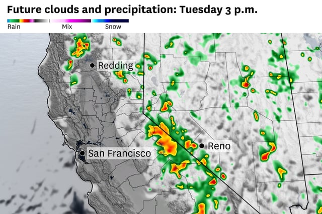
- Lingering monsoonal moisture could trigger isolated Tuesday storms in northern Napa and Sonoma, with activity expected north of the Pickett Fire.
- The greatest ignition threat sits inland — from the Central Valley and Sierra Nevada foothills to the Shasta‑Trinity Mountains and northern Sacramento Valley — where dry lightning or gusty outflows could start or spread fires.
- A more stable pattern is forecast to take hold by midweek, keeping most inland Bay Area and valley highs in the 70s to 80s and the coast in the 60s through Friday.
- Cooler nights are expected to lift humidity and ease winds, conditions that typically slow fire growth.
- Over the weekend, more than 300 lightning strikes in the Tahoe National Forest sparked nearly a dozen small fires that crews largely contained quickly.