
Overview
- Canadian wildfire smoke will filter skies through Tuesday before exiting by Wednesday morning under southerly winds.
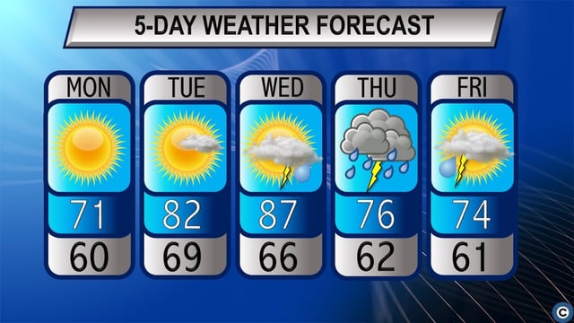
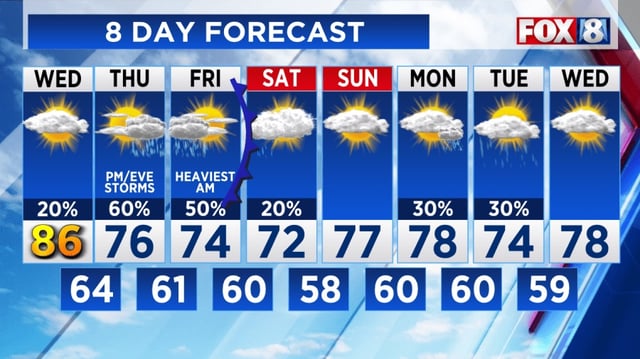
- Southwesterly flow behind departing high pressure will boost temperatures into the mid to upper 80s on Wednesday.
- A slow-moving cold front arriving Wednesday night will trigger showers and thunderstorms through Thursday night.
- The Weather Prediction Center has placed all of Ohio under a marginal risk for excessive rainfall on Thursday.
- Temperatures will fall back to the mid-70s Thursday and Friday before the front exits by Saturday morning.