
Overview
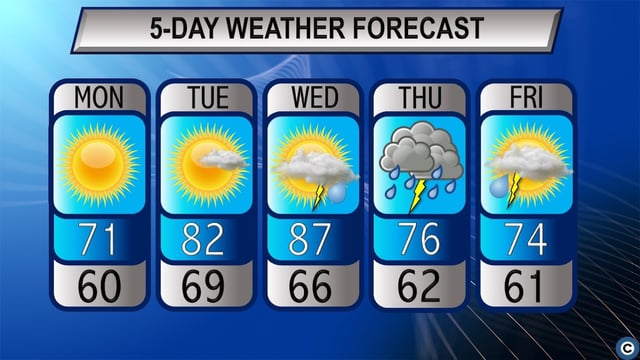
- Temperatures climbed into the mid to upper 80s on June 4, delivering an early summer heat surge across Northeast Ohio.
- Hazy skies from Canadian wildfire smoke have filtered sunlight and prompted an Air Quality Alert for parts of the region.
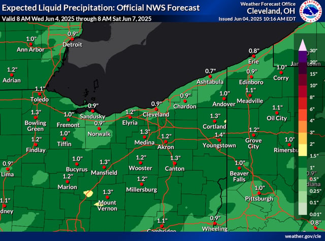
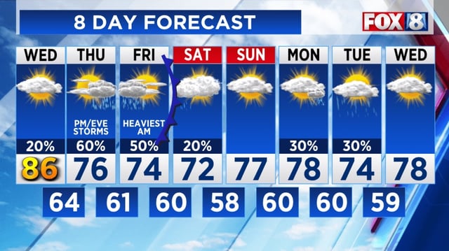
- Meteorologists predict the cold front will move in Wednesday night and produce scattered showers and isolated thunderstorms by Thursday.
- High moisture levels and moderate atmospheric instability raise the threat of localized flash flooding where storms train over the same areas.
- Once the front passes, daytime highs are expected to drop into the mid-70s Thursday and Friday with sunny, fair conditions forecast for the weekend.