
Overview
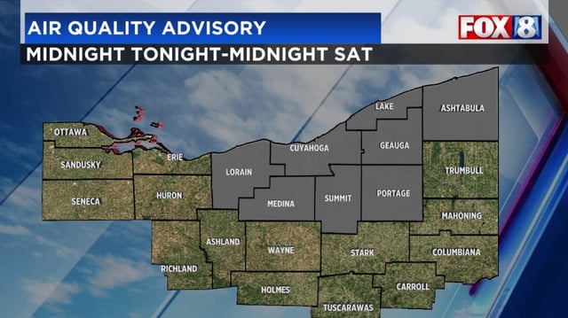
- An Air Quality Advisory is in effect through midnight Saturday for Ashtabula, Cuyahoga, Geauga, Lake, Lorain, Medina, Portage and Summit counties.
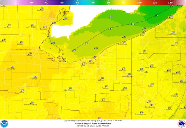
- Weekend highs will reach the low 90s with high humidity pushing heat indices into the mid to upper 90s.
- Most areas will remain dry but a stray afternoon or evening shower or thunderstorm is possible on Saturday and Sunday.
- A cold front expected early Monday will trigger scattered to numerous showers and thunderstorms across Northeast Ohio.
- After the front passes, the most intense heat will shift west and temperatures will moderate but remain warm through the first 10 days of July.