Overview
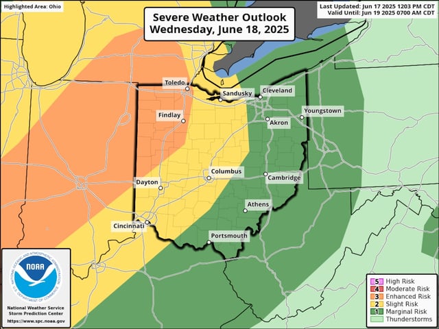
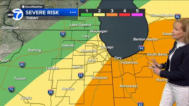
- The Storm Prediction Center has placed northeastern Ohio under marginal to enhanced severe weather risk and parts of the Chicago area in a slight to enhanced risk category today, citing threats of damaging winds, hail and isolated tornadoes.
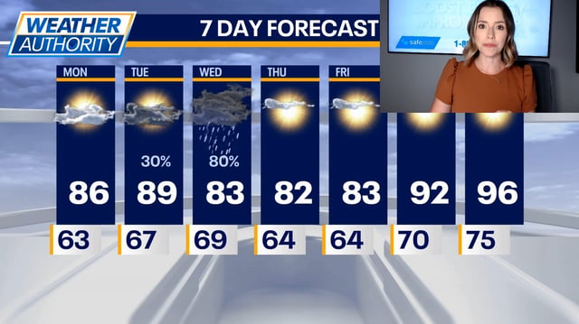
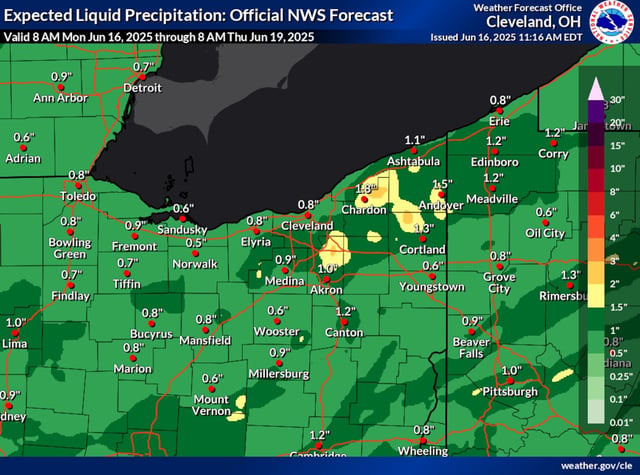
- A cold front will sweep through this evening, triggering a line of showers and thunderstorms across Northeast Ohio after 6 p.m. and moving east by midnight.
- Following the frontal passage, cooler and less humid conditions are expected on Thursday and Friday before a heat dome drives weekend highs into the mid-90s.
- Heat indices are projected to exceed 100°F across Chicago and Northeast Ohio on Saturday and Sunday, marking the region’s first sustained heat wave of the year.
- Chicago’s Department of Family and Support Services will open six cooling centers from Saturday through Tuesday to provide relief during peak heat hours.