
Overview
- May saw below-normal highs on 22 of 31 days in Cleveland and 5.30 inches of rain, making it the 19th wettest May on record.
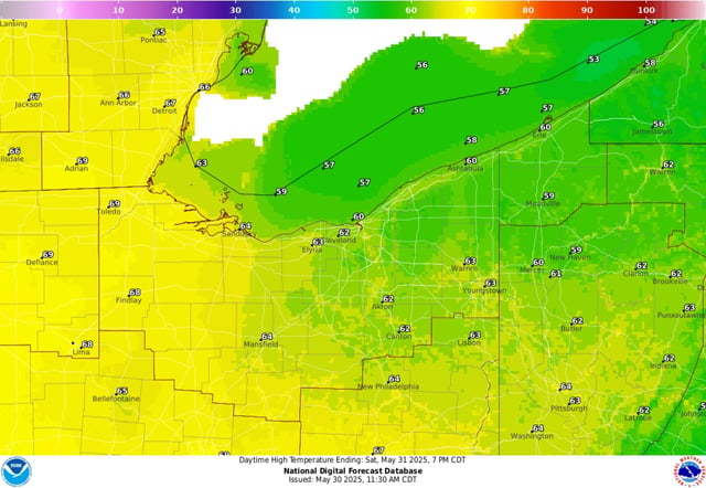
- A cold front moving through Friday night has locked in weekend highs near the low 60s with brisk northwest winds.
- Overnight lows are expected to dip into the mid-40s inland and potentially upper-30s in cooler spots despite no frost advisory.
- Northwest flow aloft could carry Canadian wildfire smoke into the region, causing a milky haze and brief air quality dips.
- A pattern shift beginning June 3 will bring sustained highs in the 80s and increasing humidity through midweek.