Overview
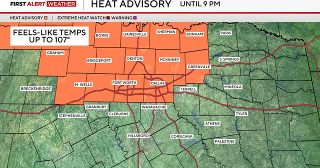
- The heat advisory expired Sunday night after drier air lowered humidity and kept heat index readings just below the 105°F threshold.
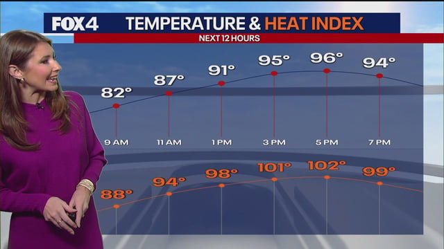
- Sunday’s highs reached the mid-to-upper 90s with heat index values around 101–102°F, leading to only isolated afternoon showers east of I-35.
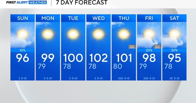
- Forecast models show a high-pressure ridge moving westward over the Plains and strengthening across North Texas early in the week.
- DFW Airport’s 338-day streak without a triple-digit reading is likely to end as next week’s ridge pushes temperatures into the 100s.
- Meteorologists warn the prolonged heat will increase the risk of heat-related illnesses and advise residents to stay hydrated and limit outdoor activity.