Overview
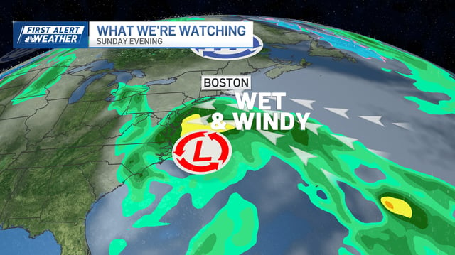
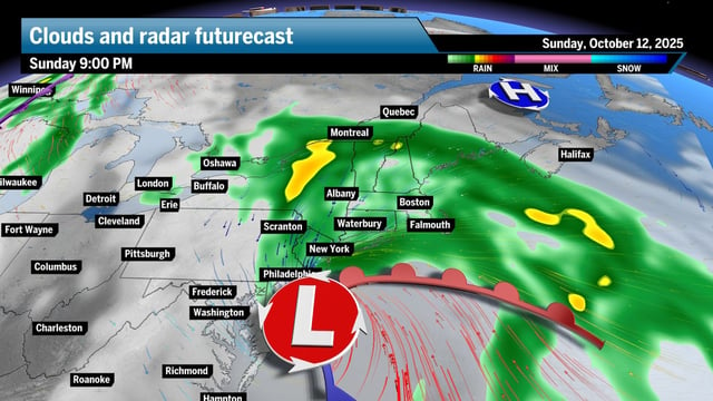
- The Weather Prediction Center says a coastal low will form off the Carolinas on Saturday and track north near or just offshore, with the greatest impacts expected Sunday night into Monday from the Mid-Atlantic to New England.
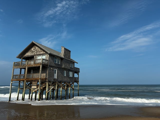
- NWS Morehead City warns of 2 to 4 feet of inundation in vulnerable areas and possible ocean overwash that could close portions of NC 12 on Ocracoke and Hatteras.
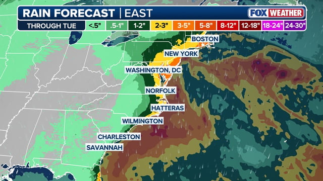
- Forecasts call for gusts of 40–50 mph along the coast, 1–3 inches of rain with locally higher totals, dangerous surf, strong rip currents and beach erosion, with a Level 2 of 4 flash flood risk flagged for parts of the NYC area on Sunday.
- Meteorologists note the system is non-tropical and may not be named, though its wind and coastal impacts could resemble a tropical storm.
- Forecasters report growing model agreement on a significant event but say the exact track will dictate severity, urging residents to monitor NWS updates and prepare for potential flooding and power outages.