Overview
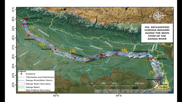
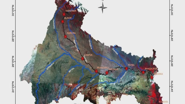
- Researchers have integrated declassified 1965–75 Corona imagery with 2018–19 land-use and geomorphic data to document shifts in the Ganga’s morphology, flow and floodplain over the past fifty years.
- All datasets will be centralized in the Ganga Knowledge Centre and organized into a Web-GIS module with advanced query tools for use by scientists, planners and the public.
- Nine digital display “windows” covering Haridwar, Bijnor, Narora, Kanpur, Allahabad, Varanasi, Patna, Bhagalpur and Farakka are being developed to deliver localized insights for decision-making.
- Comparative analysis reveals that barrages, embankments, urban expansion and agricultural growth have progressively constrained the river’s natural meanders and dynamic channels.
- IIT Kanpur researchers describe the effort as the start of a data-driven era in Ganga conservation, noting that methodology refinements and technical challenges remain under active review.