

Overview
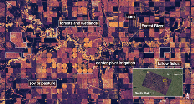
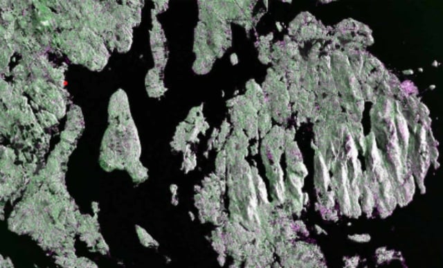
- NASA and ISRO published NISAR’s first L-band radar images, depicting Maine’s Mount Desert Island on August 21 and the Forest River region of North Dakota on August 23.
- The L-band instrument resolves features down to about 5 meters and can measure soil moisture and land or ice motion to fractions of an inch.
- NISAR is the first spacecraft to carry both L- and S-band synthetic aperture radars, with ISRO’s S-band optimized for detecting smaller vegetation and certain crops.
- Now in a roughly 747-kilometer sun-synchronous orbit, the satellite uses a 12-meter reflector to observe nearly all land and ice surfaces twice every 12 days.
- Launched on July 30, the mission remains in commissioning with science operations slated for November to deliver data for disaster response, infrastructure monitoring, and agricultural management.