

Overview
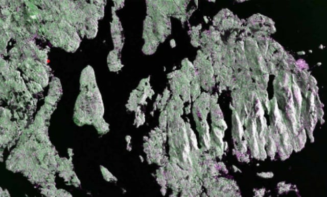
- NASA and ISRO released the first NISAR L-band radar images, captured Aug. 21 over Maine’s Mount Desert Island and Aug. 23 over northeastern North Dakota.
- The spacecraft carries the first co-hosted L- and S-band synthetic aperture radars on a 12-meter reflector to map land and ice in all weather.
- Teams raised NISAR to its operational 747-kilometer orbit in mid-September, with full science operations scheduled to start in November 2025.
- The L-band system resolves features about 5 meters across using a 25-centimeter wavelength that penetrates forest canopies and detects minute ground and ice motion.
- Mission leaders plan wide-swath, twice-per-12-day coverage and rapid, open access to processed radar data for research, agriculture and emergency response.