Overview
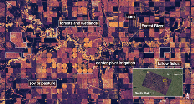
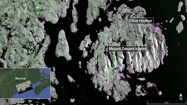
- NASA published the initial L-band radar views of Mount Desert Island, Maine (Aug. 21), and northeastern North Dakota near the Forest River (Aug. 23), revealing forests, wetlands, waterways and cropland patterns in high detail.
- The L-band instrument from JPL resolves features down to about 5 meters and its 25-centimeter wavelength can penetrate vegetation to gauge soil moisture and detect tiny motions of land and ice.
- NISAR is the first satellite to fly both L- and S-band synthetic aperture radars, with ISRO’s S-band system optimized for sensing small vegetation and monitoring certain agricultural and grassland ecosystems.
- Following orbit-raising to roughly 747 kilometers in mid-September, the spacecraft is in commissioning and is slated to start science operations in November with coverage of most land and ice surfaces twice every 12 days.
- The mission uses a 12-meter deployable antenna reflector—the largest NASA has flown for radar—and is structured as a long-term NASA–ISRO partnership with open data intended to support disaster response, infrastructure monitoring and agriculture.