
Overview
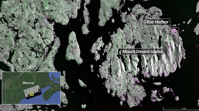
- NASA and ISRO released NISAR’s initial L-band radar images on Sept. 25, showing Maine’s Mount Desert Island from Aug. 21 and northeastern North Dakota farmland from Aug. 23.
- The L-band system resolves features about 5 meters across and distinguishes water, vegetation, and built surfaces, with a wavelength that penetrates canopies to sense soil and ice motion.
- NISAR is the first spacecraft to carry both L- and S-band synthetic aperture radars, with NASA/JPL supplying L-band hardware and ISRO’s Space Applications Centre providing S-band.
- The satellite reached its 747-kilometer sun-synchronous orbit in mid-September and uses a 12-meter deployable reflector—the largest NASA has flown—to map land and ice twice every 12 days.
- Teams remain in commissioning and calibration before beginning science observations in November, with open data intended to support disaster response, infrastructure monitoring, agriculture, and ecosystem assessments.