Overview
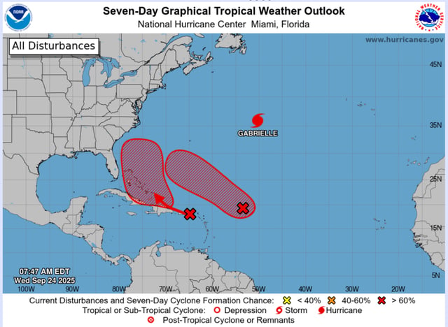
- Two western-Atlantic disturbances carry high seven-day formation odds, estimated at about 90% for one system and 80% for the other, according to the National Hurricane Center.
- The first disturbance is likely to organize into a tropical depression later today or Thursday while moving west-northwest well north of the Leeward Islands.
- Forecasters say the earlier-developing system could reach hurricane strength near Bermuda early next week, though exact intensity and track remain uncertain.
- The second system is producing heavy rain over Puerto Rico and the U.S. Virgin Islands through Friday and is likely to develop near the Bahamas by the weekend.
- Model guidance for the second system ranges from a stall offshore to a possible landfall along the Southeast U.S. coast early next week, with some meteorologists also noting a low-confidence potential for interaction between the two systems.