Overview
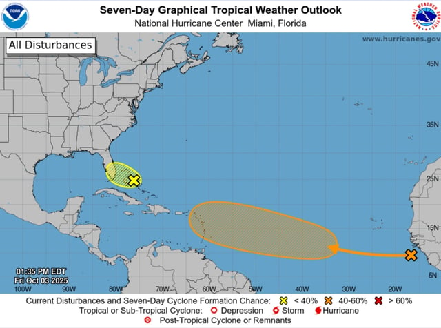
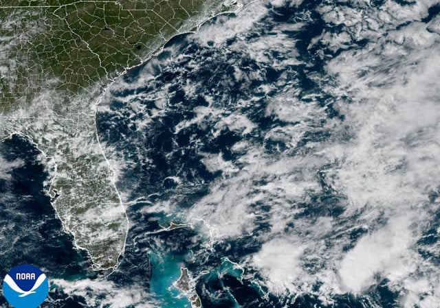
- A weak low near the central to northwestern Bahamas is drifting toward and across Florida with only a 10% chance of becoming a tropical cyclone over the next 48 hours to seven days, according to the National Hurricane Center.
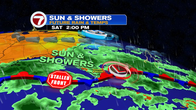
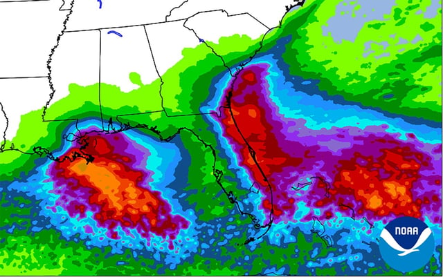
- The system is forecast to produce rounds of heavy rain with localized flooding this weekend, with NWS Miami calling for about 2–3 inches across east coast metros and isolated 4–6 inches in spots.
- Coastal hazards persist along Florida’s east coast, with high rip current risk, high surf of 5–8 feet in places, and flood watches issued for parts of east-central Florida.
- Farther east, a tropical wave that just moved off Africa has a 0% chance of development in 48 hours but a rising 7‑day probability of 40–50%, and a tropical depression could form near or east of the Lesser Antilles by late next week.
- Forecasters cite very warm waters and pockets of lower wind shear supporting potential development later in October, though model guidance on track and intensity remains highly uncertain; the next name on the list is Jerry.