Overview
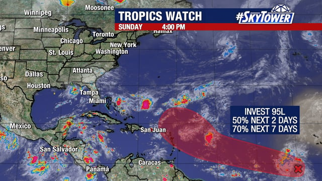
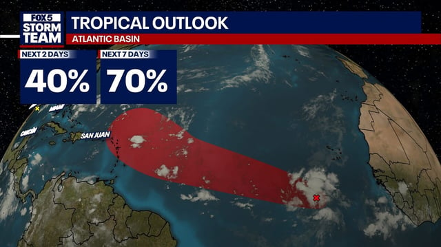
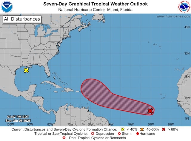
- The National Hurricane Center's 2 p.m. outlook increased development chances for Invest 95L to 50% in 48 hours and 70% over seven days.
- The broad, disorganized low several hundred miles south-southwest of the Cabo Verde Islands is forecast to race across the central tropical Atlantic and approach the Leeward Islands late this week.
- Forecast guidance widely agrees the system will near the northeastern Caribbean Thursday or Friday before turning north into the central Atlantic.
- Strength remains uncertain, with Google DeepMind guidance favoring a peak at tropical storm intensity, which would take the name Jerry, as dry air and the system’s large size hinder rapid organization.
- Separately, the NHC lowered Gulf development odds to 0% for a system lingering off Louisiana, Mississippi and Alabama, while a different coastal low continues to produce rough surf and high rip currents along Florida’s east coast.