
Overview
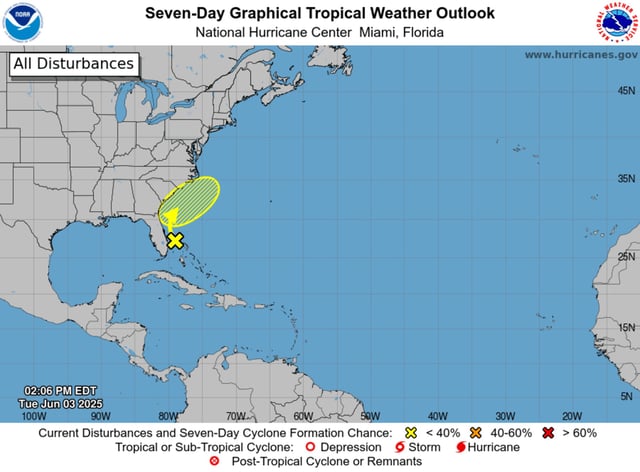
- Forecasters assign the offshore low-pressure area a 10 percent chance of tropical or subtropical development over the next seven days, with coastal waters still below the 80°F threshold needed for sustained intensification.
- The disturbance is expected to move north-northeast at 10–15 mph, passing east of North Carolina by late Friday or Saturday before heading back out over the Atlantic.
- Even without acquiring tropical characteristics, the system is set to produce heavy rainfall, local flooding and heightened rip currents along the Southeast coast this week.
- Meteorologists caution against relying on single-model forecasts circulating on social media, which have been debunked as depicting a phantom early-season storm.
- NOAA anticipates between 13 and 19 named storms this season, and the first will be designated Andrea.