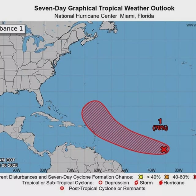
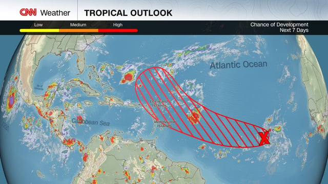
Overview
- The disturbance has a 50% chance of development in 48 hours and 70% in seven days, with a tropical depression considered likely by midweek.
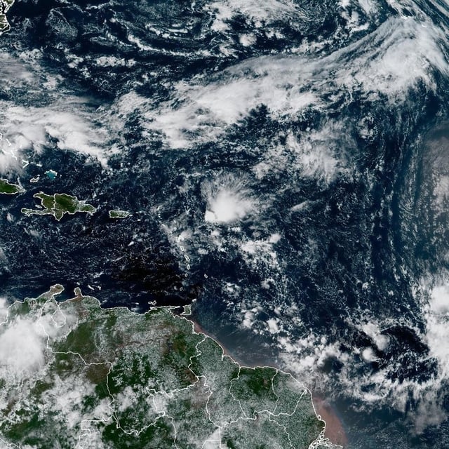
- A broad low with disorganized showers sits several hundred miles southwest of the Cabo Verde Islands and is moving quickly west-northwest.
- Forecast models generally bring the system near the northern Leeward Islands late this week before turning it away from the U.S., aided by an East Coast frontal pattern.
- Saharan dust and dry air may limit rapid strengthening even as overall conditions favor gradual development.
- Authorities urge interests in the northeast Caribbean to monitor updates and prepare, and it remains too early to determine any U.S. impacts; the next storm name would be Jerry.