Overview
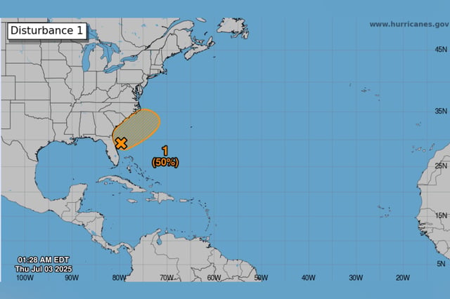
- The National Hurricane Center now assigns the disturbance a 10% chance of development within 48 hours and a 50% chance over seven days, with formation possible July 4–7.
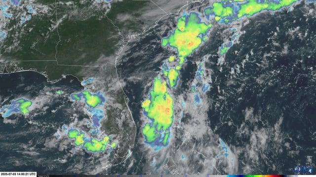
- Forecast models vary on where the low will consolidate—some place its center over the Gulf’s Nature Coast, others offshore near Jacksonville—leading to track uncertainty.
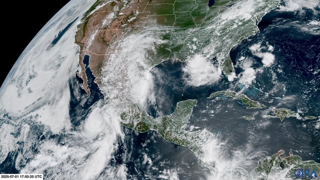
- Regardless of cyclone formation, the stalled frontal boundary is expected to drive repeated heavy showers and thunderstorms over Florida and into coastal Georgia and the Carolinas, prompting marginal to slight flood risk alerts.
- Warm sea surface temperatures off Florida’s northwest Gulf coast favor storm growth, while cooler Atlantic waters along the northeast coast could inhibit development.
- If the system organizes into a tropical storm, it will be named Chantal, marking the third named storm in a season NOAA predicts will produce 13–19 named storms, including 6–10 hurricanes.