Overview
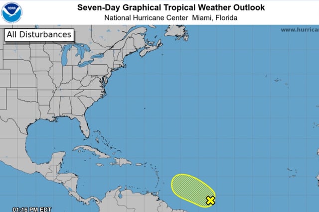
- The National Hurricane Center’s July 21 midday outlook trimmed the disturbance’s chance of becoming a tropical cyclone to 10% over both the next 48 hours and the next seven days.
- Forecasters first assigned a 10% development probability on July 18, raised it to 20% in early July 21 forecasts, then reduced it again as environmental indicators worsened.
- The system is moving westward at about 15 miles per hour across the central tropical Atlantic while generating disorganized showers and thunderstorms.
- Increasing wind shear and the intrusion of dry Saharan air are expected to inhibit any significant organization before conditions turn hostile by midweek.
- This wave remains part of NOAA’s 2025 Atlantic hurricane season monitoring, which projects 13–19 named storms, 6–10 hurricanes and 3–5 major hurricanes.