Overview
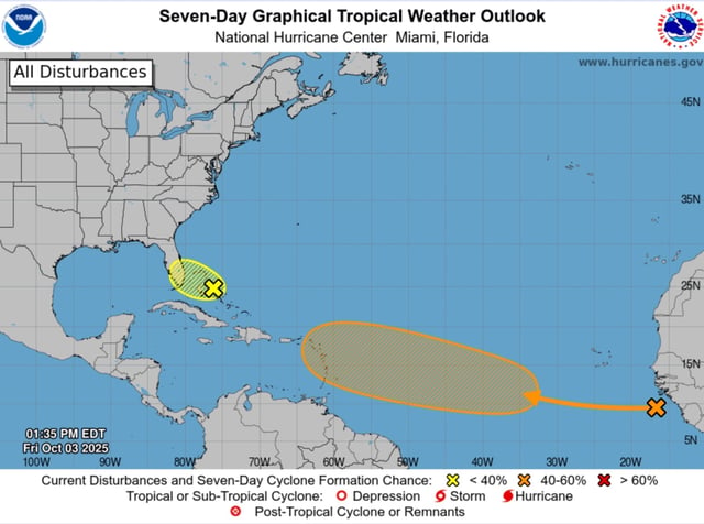
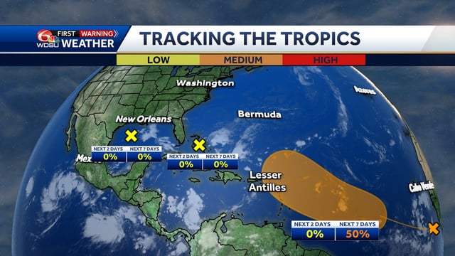
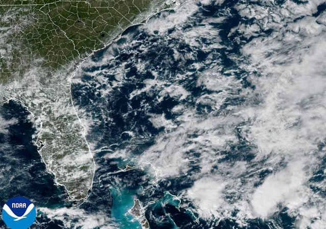
- The National Hurricane Center’s Saturday morning outlook reduced the Bahamas–Florida low to a 0% chance of tropical cyclone formation, though heavy rain could trigger flash flooding in parts of Florida and the northwestern Bahamas.
- Flood watches are posted for portions of east‑central Florida through Sunday, with high surf and a high rip‑current risk along the east coast where 5–8 foot breakers and small craft advisories are in effect.
- The weak low will meander near Florida and the Bahamas through the weekend, drifting west‑northwest as strong upper‑level winds keep it disorganized and limit it to a rainmaker.
- A separate tropical wave just off Africa carries a 50% seven‑day development chance, with forecasters saying a tropical depression could form near or east of the Lesser Antilles by the middle to latter part of next week.
- A weak low in the north‑central Gulf also holds 0% development odds as it moves toward the Texas coast, with no cyclone formation expected but some added moisture possible for Gulf Coast rain chances.