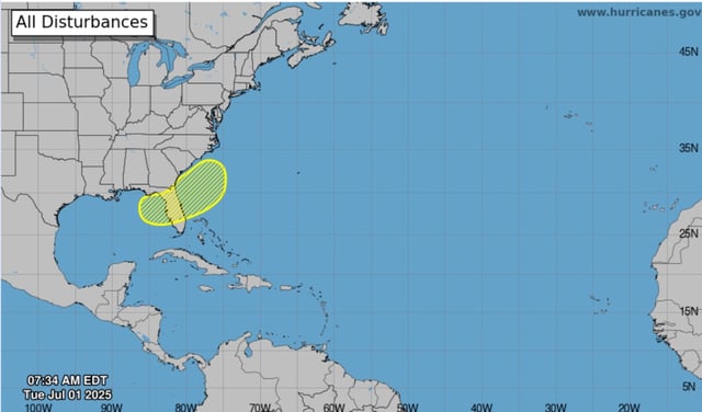
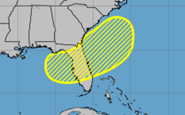
Overview
- A stalled frontal boundary offshore is expected to spawn a low-pressure area later this week that could linger off Florida’s Gulf and Atlantic coasts.
- The National Hurricane Center increased the disturbance’s seven-day formation probability from 20% to 30% in its July 1 tropical outlook.
- Forecasters say any developed system would take the next name on the list, Tropical Storm Chantal.
- Above-average sea surface temperatures in the northwest Gulf of Mexico may enhance storm formation while cooler Atlantic waters dampen intensification.
- Repeated rounds of showers are forecast to drop 2 to 4 inches of rain across much of Florida during the holiday weekend, with marginal excessive rainfall risks in east Central regions.