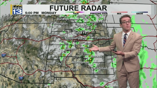
Overview
- Very humid surface air persists, with pockets of rain dissipating across northern, central, southeastern and higher-elevation areas.
- Isolated thunderstorms remain possible in the mountains, southern and eastern zones and parts of the Rio Grande Valley.
- Stronger cells could still produce small hail and gusty outflow winds even as flooding becomes less likely.
- A daily shift from muggy easterly mornings to drier southwesterly afternoons continues, bringing patchy fog to northern valley floors and occasional east-gap gusts.
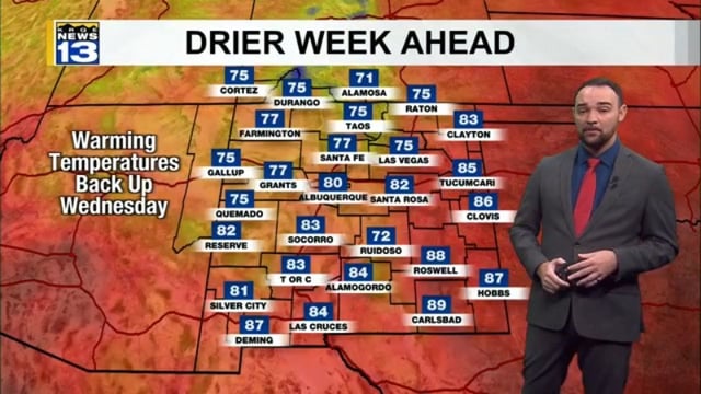
- Temperatures trend warmer, with most highs in the upper 60s and 70s, cooler 50s on the highest northern peaks and upper 70s to low 80s in the south and southwest.