Overview
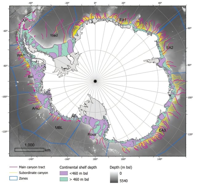
- The catalog identifies 332 submarine canyon networks across the Antarctic seafloor, five times more than in prior studies.
- Researchers employed Version 2 of the International Bathymetric Chart of the Southern Ocean with new high-resolution data and a semi-automated GIS protocol to systematically detect and profile canyons.
- Some canyons exceed depths of 4,000 meters, reflecting enhanced glacial erosion and deep turbidity currents unique to polar regions.
- East Antarctic canyons form complex, branching U-shaped systems, while those in West Antarctica are shorter, steeper and exhibit V-shaped cross sections.
- The study warns that omitting canyon-scale processes from current ocean circulation models undermines predictions of ice-shelf stability and global sea-level rise.