Overview
- Erin became the first hurricane of the 2025 Atlantic season and is expected to strengthen into a major hurricane as it passes near the Leeward Islands on Saturday.
- Although the storm poses no direct threat to U.S. landfall, it is forecast to generate significant wave heights and dangerous rip currents along the Massachusetts coast and wider East Coast through early next week.
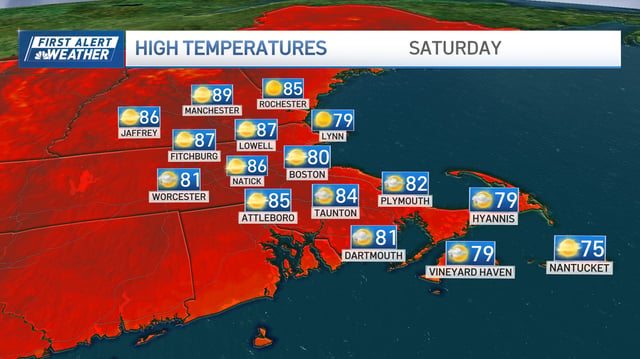
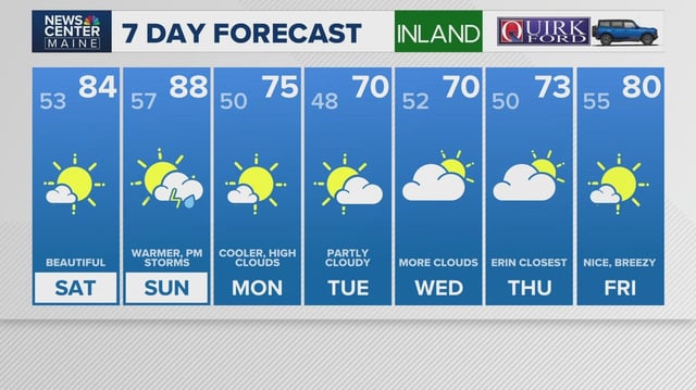
- Saturday’s forecast calls for mostly sunny skies and mild temperatures ideal for beachgoers and hikers in New England.
- Sunday will be the warmest day with highs climbing into the upper 80s and low 90s and isolated afternoon thunderstorms as a cold front moves in.
- The cold front will bring a sharp cooldown Monday with highs falling into the 60s and 70s and increased chances of showers and gusty winds across coastal waters and mountain summits.


