Overview
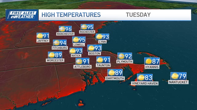
- Southern New England cities have recorded highs in the low-to-mid 90s with heat-index values climbing toward 100.
- Persistent high pressure is trapping ozone near the surface and Canadian wildfire smoke is drifting south, degrading air quality and prompting health alerts.
- Rising dew points into the upper 60s are increasing mugginess and could warrant a heat advisory in Boston and other urban areas.
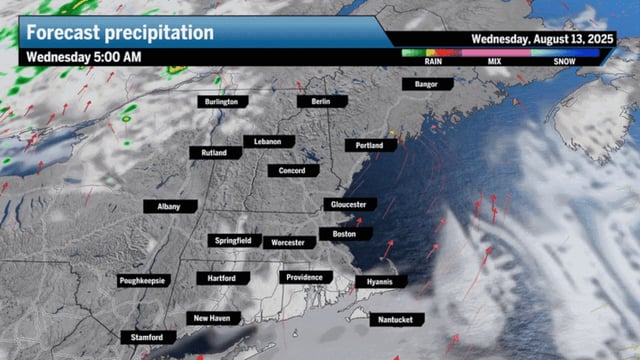
- Scattered thunderstorms are forecast Wednesday afternoon with isolated heavy downpours that may cause brief flash flooding in western and northern parts of New England.
- Forecasters are monitoring Tropical Storm Erin in the Atlantic for possible strengthening even as its impact on the U.S. remains uncertain.