
Overview
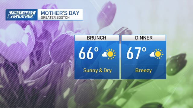
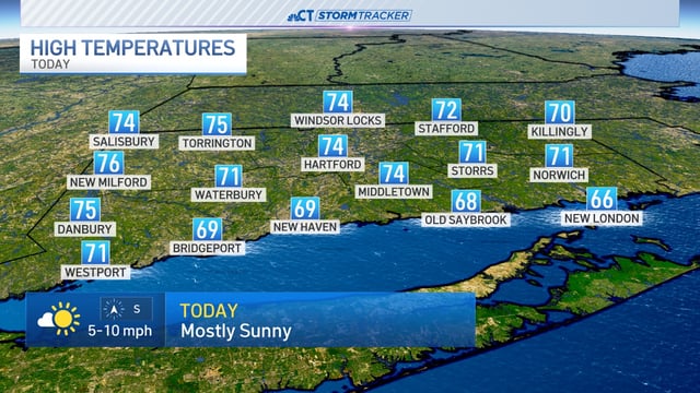
- High pressure over New England is bringing clear skies, dry weather, and daytime highs in the 70s early this week.
- Overnight radiational cooling is dropping temperatures into the 30s and 40s inland, with patchy frost possible in northern and suburban areas.
- A backdoor cold front on Tuesday will cool coastal areas, including Boston, into the 50s by evening with increased cloud cover and a northeast breeze.
- Humidity and rain chances increase late Wednesday into Friday, with scattered showers and possible thunderstorms expected by the weekend.
- Inland temperatures are forecast to climb toward the low 80s by Friday and Saturday, marking a warm end to the week.