
Overview
- Interior New England topped 90°F on Thursday, marking Logan Airport’s first 90-degree day of the season
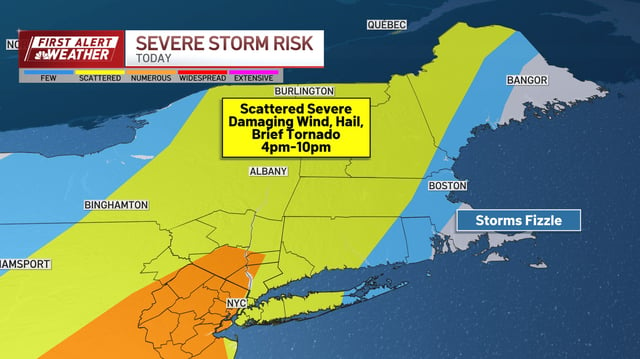
- Western and northern areas faced a chance of severe thunderstorms Thursday evening with risks of damaging winds, hail and isolated tornadoes
- Friday delivered relief with mostly sunny skies, low humidity and highs in the lower 80s as Canadian air moves in
- The weekend will remain mostly sunny with highs in the 80s, a spotty shower risk and rising humidity that could push inland feels closer to 90°
- Early next week a dome of high pressure is forecast to trigger a multi-day heat wave with mid- to upper-90s temperatures and heat indexes near 110°, prompting advisories and health warnings