
Overview
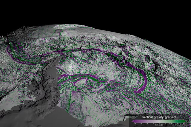
- The SWOT satellite, launched in 2022 by NASA and CNES, uses advanced radar technology to map the ocean floor by detecting subtle changes in sea surface height caused by gravitational differences.
- SWOT has doubled the resolution of previous satellite maps, achieving a 5-mile resolution and identifying up to 100,000 seamounts, compared to 44,000 previously known.
- Abyssal hills, now recognized as Earth's most common landform, cover 70% of the ocean floor and were revealed in unprecedented detail by SWOT data.
- The maps support practical applications such as safer submarine navigation, improved underwater cable installation, and enhanced studies of tectonic activity and ocean currents.
- SWOT's data collection, covering 90% of Earth's surface every 21 days, is accelerating efforts to complete a comprehensive ocean floor map by 2030.