


Overview
- Thursday’s storms dumped more than six inches of rain in Hingham and triggered flash flood warnings for Northampton, Hatfield and Hadley.
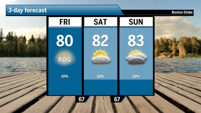
- Weekend conditions will be governed by a pocket of weak high pressure, bringing a mix of sun and clouds.
- Patchy coastal fog may linger into mid-morning before clearing to sunshine across the region.
- A cold front is expected to move through on Monday, bringing scattered storms and the chance for heavier downpours.
- By mid-next week, forecasters say average highs near 83°F could trigger a heat wave from July 16 to 22.