
Overview
- The SMN 06:00 forecast calls for very heavy to locally intense rain of 75–150 mm in southern Guerrero, eastern and coastal Oaxaca, southern Veracruz, western Tabasco, much of Chiapas, and western to southwestern Campeche.
- Strong to very strong accumulations of 50–75 mm are expected in Jalisco, Colima, Michoacán and Puebla, with additional showers and storms across the central region.
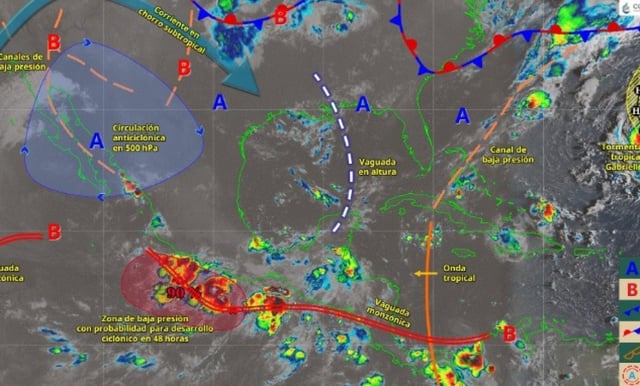
- The Mexican monsoon, subtropical jet moisture and multiple low‑pressure channels will generate showers to heavy rains in the Baja California Peninsula, Sonora, Chihuahua, Durango, Sinaloa and Nayarit.
- A low‑pressure area south of Guerrero and Oaxaca with potential for cyclonic development, together with the monsoon trough, will enhance rainfall over the Pacific west and the country’s center.
- Officials caution that storms will feature frequent electrical activity with possible hail, reduced visibility on roads, rapid rises in rivers and arroyos, urban flooding and landslides, with coastal gusts of 40–60 km/h on the Michoacán, Guerrero and Oaxaca coasts.